Discover the most beautiful hikes in the Mont Blanc massif!
Located in the Alps, it is known to host the highest peak in Europe. A group of mountains of 400 km² which offers multiple possibilities of excursions on 3 countries, here is a destination of dream for the lovers of mountain.
The Mont Blanc massif is appreciated in winter thanks to its ski slopes and its numerous activities but also in summer.
The many hiking trails in the Mont Blanc massif are fabulous.
Indeed, the Mont Blanc massif is an ideal place to enjoy the atmosphere of the high mountains and to admire the sumptuous landscapes punctuated by glaciers, eternal snow and flowery, rocky or even forest trails.
Here, discover 10 hikes in the Mont Blanc Massif that you should do at least once 🙂
Navigation rapide :
- Plan de l’Aiguille / Montenvers
- Lac Blanc
- La Jonction
- Aiguillette des Houches
- Refuge Albert 1er
- Chalet de la Loriaz
- Refuge Bonatti
- Lac Combal
- Mont Chétif
- Fenêtre d’Arpette
1/ Hike from Plan de l’Aiguille to Montenvers
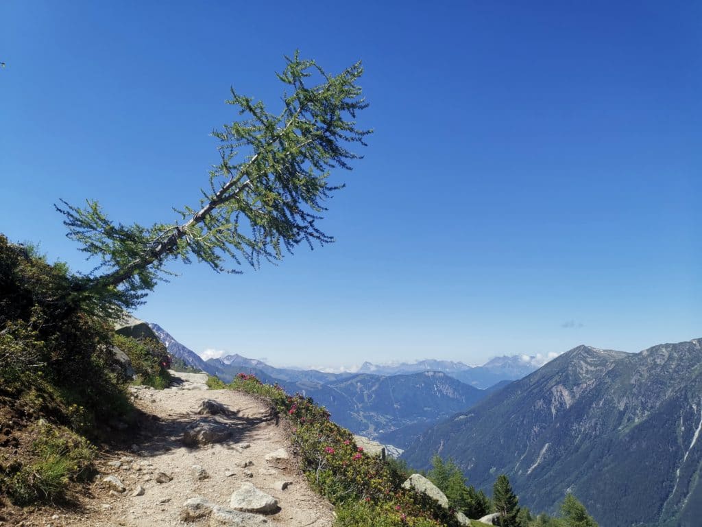
The Plan de l’Aiguille hike in brief :
- Difference in altitude: 171 m D+ / 562m D-
- Distance : 6.5 km
- Type : loop
- Starting point: Arrival of the Plan de l’Aiguille cable car + descent by train
- Difficulty: Easy
This hike in the Mont Blanc massif takes place in the Chamonix Valley on the large northern balcony, in the middle of the mountain. It is a hike accessible to all since transportation can be taken.
It can be done in one day in a very pleasant loop. The loop can be done in both directions, we describe the most pleasant direction.
This hike from Chamonix offers two possibilities:
- The best hikers can go directly on foot along the path, which is made up of a succession of laces in the forest below the cable car. They will walk along the slope passing by the Alpages de la Blaitière.
- This starting point is also served by the cable car of the Aiguille du Midi which you can take by stopping at the plan de l’Aiguille. This will save you the steep ascent.
Then, the two paths meet on a transversal path which offers a magnificent view of the valley and the Aiguilles de Chamonix. This hike in the Mont Blanc massif is an opportunity to see a landscape that changes little by little, giving way to rocks, glaciers in the distance and vertiginous peaks.
You will then go down by laces which will lead you to the Montenvers station where the sea of ice is present.
For the descent, it is as for the rise two possibilities are offered to you:
- You still have strength to swallow the descent, in this case you take the path which will lead you in the valley through the forest
- But if you have walked enough or if you want to discover the joys of a train trip, it will bring you back down to the valley in no time.
2/ Lac Blanc hike
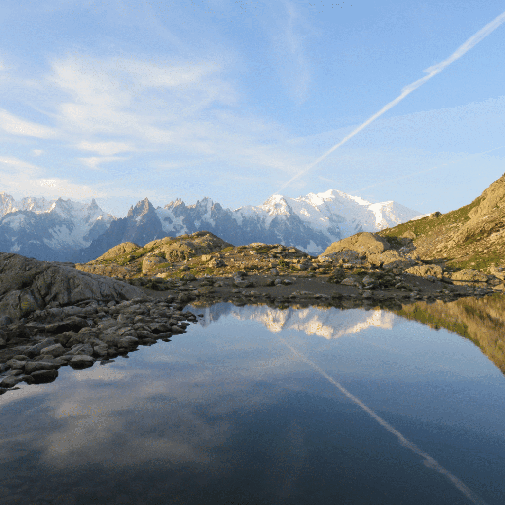
The Lac Blanc hike in brief:
- Difference in altitude: 540 m D+ / 540 m D-
- Distance : 6.6 km
- Type: round trip
- Starting point : Arrival of the Flégère cable car
- Difficulty: Medium
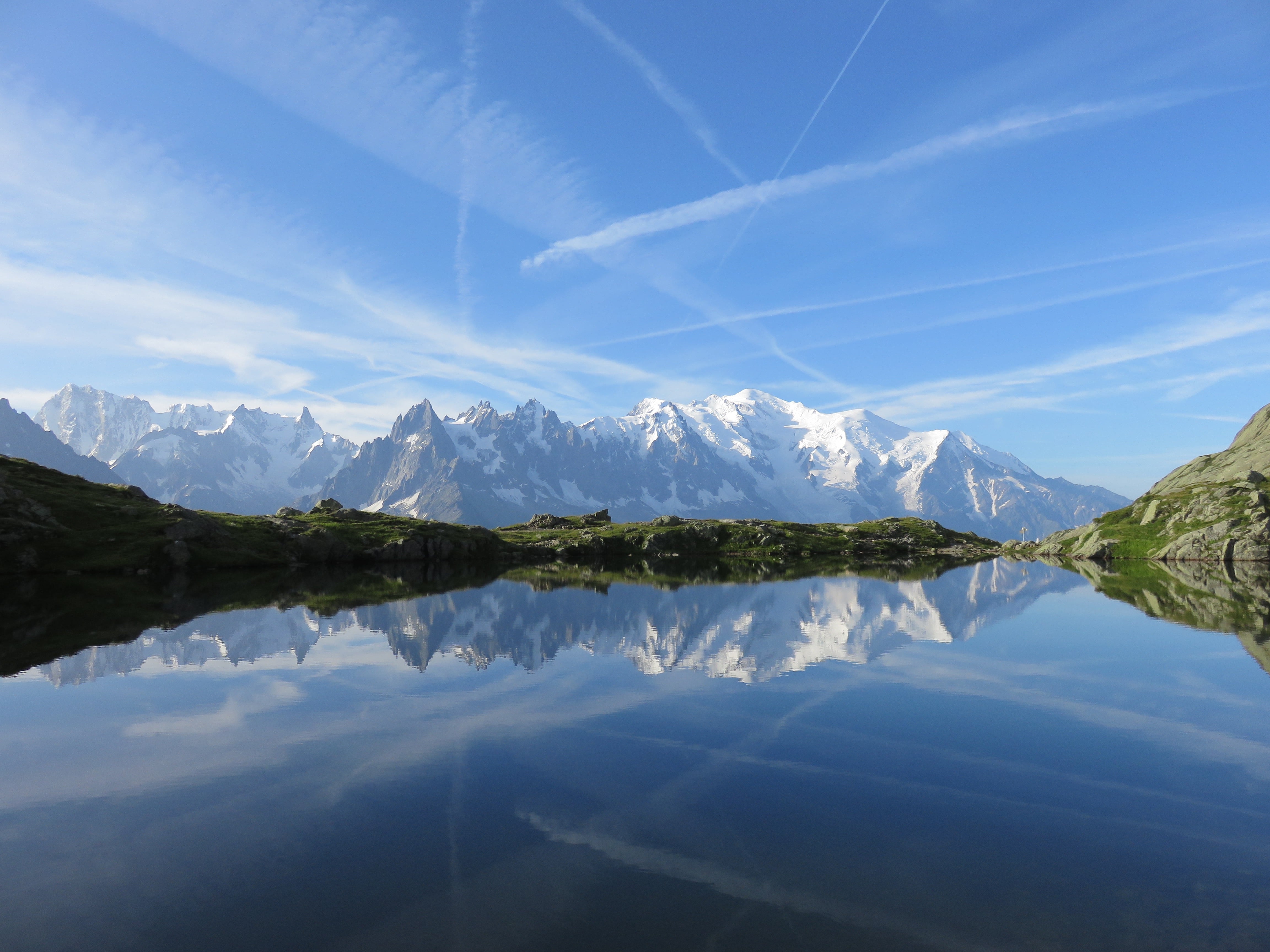
The Lac Blanc is a hike in the Mont Blanc massif that is mythical because of the splendor of the place. Indeed, this hike offers a balcony view of the Chamonix valley and all the surrounding peaks from the Mont Blanc range to the Aiguilles Rouges.
This mountain lake is known all over the world for its transparent water in which the reflection of Mont Blanc can be seen. A perfect playground for photography enthusiasts who discover and show the hikes in the Mont Blanc massif through their pictures.
However, before reaching this place, more or less effort is required. Before venturing there, you should know that some passages are delicate because it is necessary to cross ladders fixed to the rock.
The Lac Blanc is part of the Aiguilles Rouges nature reserve. You will be able to meet ibexes and hear the marmots’ field. But please note that our animal friends are strictly forbidden on this hike.
Multiple trails lead to the Lac Blanc, among the two main ones, the duration and the difference in altitude vary, so you will have to choose according to your level and your desires.
For the more adventurous, you can set your starting point at the Col des Montets, located on the itinerary of the Tour du Mont Blanc, the trail starts with large laces in the forest that will allow you to rise on the balcony.
Then, for those who are not used to walking in the mountains, you can take the Flégère gondola which will save you a good half of the route. You will only have to walk on the path that crosses horizontally.
The two trails meet at the Lac des Cheserys before the Lac Blanc. All you have to do is climb a few ladders on the trail to reach the Lac Blanc refuge and admire the beauty of the panorama and the reflections in the lake. If you walk along the right side of the lake you can see the second part of the lake with sometimes still a little snow. You will come back down the same way.
3/ La Jonction
The hike in brief:
- Difference in altitude: 1155 m D+ / 1155 m D-
- Distance : 10.2 km
- Type: round trip
- Starting point : arrival of the chairlift
- Difficulty : Difficult
The Jonction is a classic hike in the Mont Blanc massif. Indeed, it is the place where the Bossons and Taconnaz glaciers meet. Today, with global warming, it is the rocks that make the junction between the two glaciers.
It is a magnificent viewpoint to admire the glaciers, their seracs and crevasses. You will also have a pleasant view of the Aiguille du Midi and the Dôme du Goûter, then, in front of you, the Aiguilles rouges.
This hike does not have any difficult passages but has a high cumulative altitude difference. The starting point is located at the Glacier des Bossons car park near the Route Blanche leading to Chamonix. You can take a chairlift to reduce the difference in altitude. The path goes into the forest with a series of steep switchbacks. Further on, you will go down some very steep stairs equipped with a chain, then you continue along the Bossons glacier.
You will be able to contemplate the view and then come back down by the same path. An important point to note is that this hike in the Mont Blanc massif is very dangerous when snow is present, so it is imperative to venture out in dry weather.
4/ Aiguillette des Houches hike
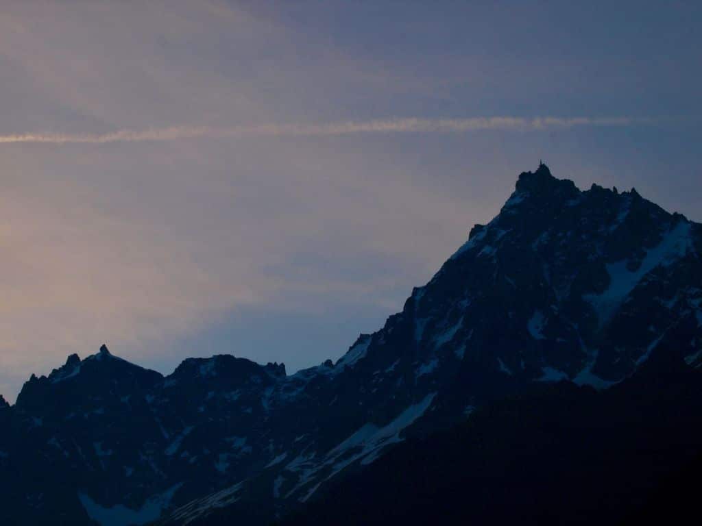
The hike in brief:
- Difference in altitude: 937 m D+ / 937 m D-
- Distance : 9.7 km
- Type : loop
- Starting point : Parking du Bettey
- Difficulty: Medium
The Aiguillette des Houches is an original and unusual hike in the Mont Blanc massif. It is possible to make a loop starting from the Parc de Merlet in Les Houches or from the car park of Le Bettey which is less saturated during the tourist season.
We suggest you start from the Bettey car park, the path leading to Pierre Blanche is more pleasant. Then, you will arrive at the Aiguillette des Houches. This hike will allow you to discover the natural reserve of Carlaveyron. The panoramic view is magnificent with the Mont Blanc range, the Aiguilles Rouges massif and the Fiz range.
After observing these numerous summits, it is time to go down, with a passage through the mountain pastures to reach the chalets of Chailloux.
Do you have some time left? Take a break from your hikes in the Mont Blanc massif and come and visit the Merlet park to discover the fauna and flora of the mountains. A visit that will please both young and old.
5/ Hike to the refuge Albert 1er
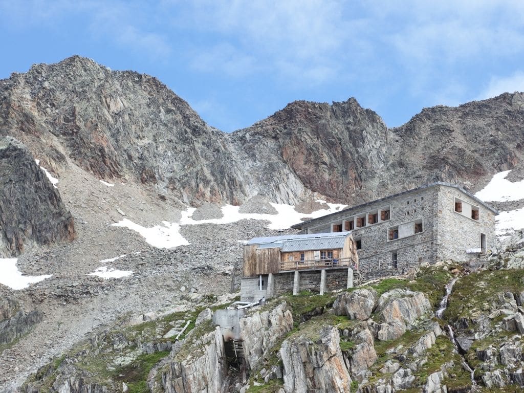
The Albert 1er refuge hike in brief:
- Difference in altitude: 1 248 m D+ / 1 248 m D-
- Distance : 10.4 km
- Type : loop
- Starting point : Car park of the Tour cable car
- Difficulty : Difficult
This hike near Chamonix is accessible to all and offers you the possibility to discover the high mountain. The Albert 1er refuge, located on the Haute Route of the Tour du Mont Blanc, is unique because it is one of the only high mountain refuges accessible to families.
This hike in the Mont Blanc massif starts with a climb in the Moraine, a rather steep slope in the rock debris. The Albert 1er hut is located above the Tour glacier, the imposing glacier that the trail follows throughout the hike. The view on the glacier is spectacular as well as the fact of being at such an altitude.
This hike does not present any major difficulty but it is not recommended for people with vertigo. Indeed, a short aerial passage equipped with a ramp is to be crossed.
For the descent, you can take the same shorter trail but very intense for your joints. We advise you to go through the Chalet de Charamillon.
6/ Chalets de la Loriaz
The Chalets de la Loriaz hike in brief:
- Difference in altitude: 722 m D+ / 722 m D-
- Distance : 11 km
- Type : loop
- Starting point : Car park in the hamlet of Le Buet
- Difficulty: Medium
This hike in the Mont Blanc massif starts in a small hamlet called Le Buet after Argentière. It’s a perfect hike to do with your family. You can make a small loop by going up through Les Granges. Then, you will arrive in a charming mountain pasture with several small chalets, that of Loriaz.
On arrival, you can contemplate the valley with a view of Argentière, Vallorcine and of course the beautiful panorama of the Mont Blanc massif. In summer, when the weather is hot, you can enjoy the coolness of the forest by descending through the forest below the Loriaz refuge.
7/ Bonatti refuge
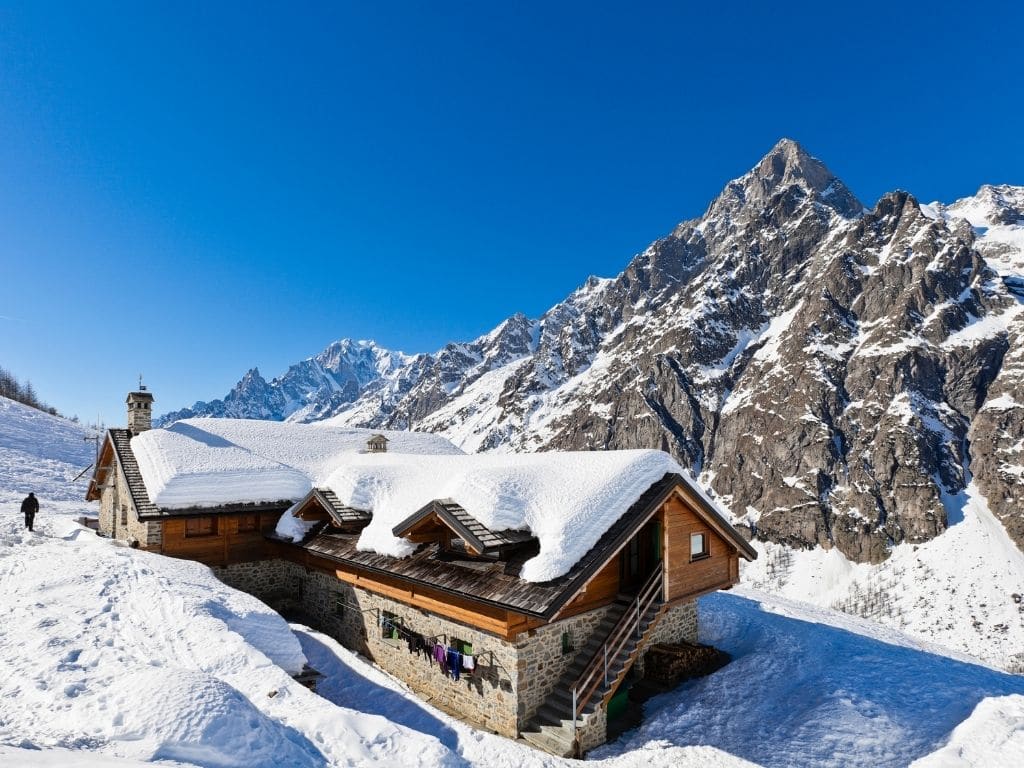
The Bonatti refuge hike in brief:
- Difference in altitude: 992 m D+ / 992 m D-
- Distance : 11.5 km
- Type : loop
- Starting point: Pra Sec (Courmayeur)
- Difficulty: Medium
With this hike in the Mont Blanc massif, we change country to go to the Italian side.
The start of this hike is from the upper Courmayeur in the Val Ferret at Pra Sec. It is considered one of the most beautiful stages of the Tour du Mont Blanc. The trail to the Bonatti hut offers a spectacular view from the ridge. You have the opportunity to make a loop if you go up through Arminaz.
When we arrive at the refuge, we have the feeling of being cut off from the world. Indeed, the Bonatti refuge is far from the Aosta Valley and has no access road.
You can take the same path to go down or choose to prolong your change of scenery by spending the night at the refuge.
8/ Lake Combal hike
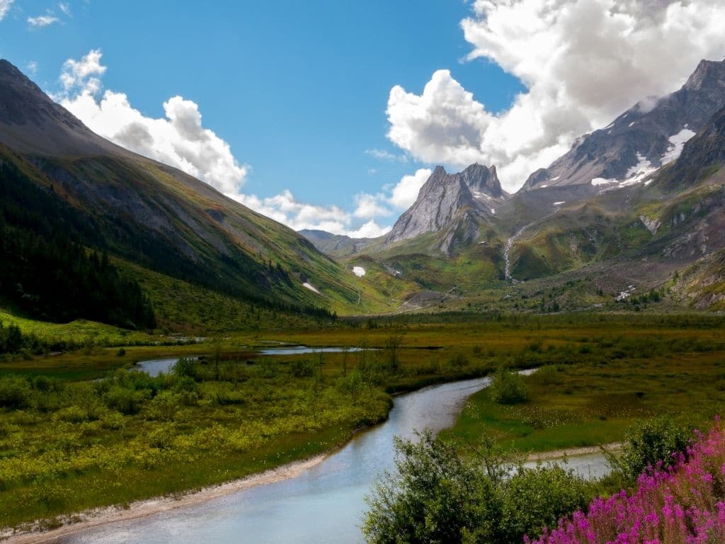
The Lake Combal hike in brief:
- Difference in altitude: 390 m D+ / 390 m D-
- Distance : 7 km
- Type: round trip
- Starting point : La Visaille
- Difficulty: Easy
For many, this route is one of the most beautiful hikes in the Alps!
Staying in Italy, from Courmayeur, you can go to Lake Combal. You will find a real haven of peace in this region of the Val Veny. The path will allow you to evolve under the impressive glacier of Miage. Then, when you reach a flat area, you will see the wild Combal lake, now partly covered by vegetation.
A splendid view of the Aiguille des Glaciers, the Col de la Seigne and the Elisabetta Soldini hut awaits you. Continuing your hike in the Mont Blanc massif, you will find the Miage lake which is a glacier lake. This lake with grey water receives large blocks of ice coming off the glacier.
If you have time, you can go to the Elisabetta Soldini hut which is the starting point of the Mont Blanc by the Italian normal route.
9/ Mont Chétif
The Mont Chétif hike in brief:
- Difference in altitude : 1 170 m D+ / 1 170 m D-
- Distance : 11 km
- Type: round trip
- Starting point : Dolonne (Courmayeur)
- Difficulty: Medium
To get closer to the Italian side of the Mont-Blanc massif, you can go to Mont Chétif. The departure takes place on the Courmayeur ski area by taking the normal route and not by the via ferrata. The path starts with a succession of switchbacks in the forest, then a fairly steep rocky corridor.
On arrival, you will see a wonderful view of the Italian Mont Blanc, the Brenva glacier as well as sumptuous peaks such as the Grandes Jorasses. You will find yourself at the foot of these impressive giants.
You can also choose on this same hike in the Mont Blanc massif to take the via ferrata. This variant goes through the via ferrata of the bicentenary. The latter was created in 1986 to celebrate the bicentenary of the first ascent of Mont Blanc.
This is not a via ferrata as such because no specific equipment is required. It is an aerial path equipped with cables and metal steps, the progression is more difficult than on a classic hiking path in the Mont Blanc massif.
10/ Hike to the Fenêtre d’Arpette
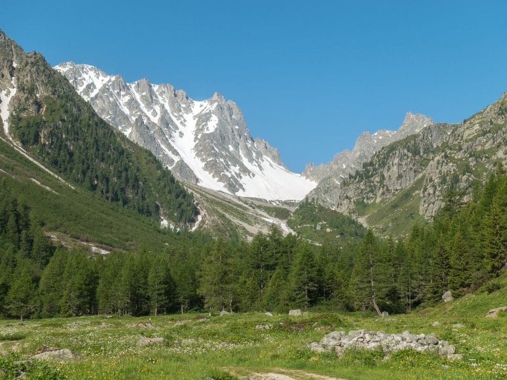
The hike in brief:
- Difference in altitude : 1 040 m D+ / 1 040 m D-
- Distance : 9.5 km
- Type: round trip
- Starting point : Arpette
- Difficulty: Medium
This hike, located at the North-East end of the Mont-Blanc massif, allows you to enjoy a constant view on the Trient glacier. This part is on the Swiss side from the Col de la Forclaz. The hike starts slowly with a forest path with explanatory panels about the history of the place.
A steeper slope leads up to a beautiful forest ridge. The Fenêtre d’Arpette is a small rocky pass at 2,665 metres.
A variant is possible from Arpette, by going back and forth on the other side for a different landscape and a trail just as pleasant. You can also, from Arpette, consider a simple crossing by getting picked up by car at the Col de la Forclaz.
Most of these hikes in the Mont Blanc massif are part of the Tour du Mont Blanc (TMB). If you have a little more time, the TMB can be done in 4 to 10 days and will allow you to discover the whole massif.

0 Comments